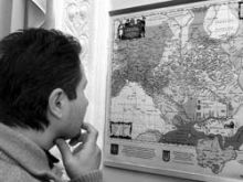
In an attempt to apply not only a “tough” but “soft” stance in relations with its neighbors, Russia’s Ministry of Foreign Affairs has backed a new project in the sphere of cultural diplomacy project: a book of geographical and topographical maps of Ukraine drawn by Guillaume Le Vasseur de Beauplan in the mid-17th century, which was launched in Kyiv last Friday. On the invitation of Polish King Sigismund III, Beauplan participated in building fortifications on the Polish-Lithuanian Commonwealth’s southern border in 1630-1647, and in the process the famous French engineer drew detailed maps of Ukraine.
Rostyslav Sossa, chief of the State Service of Geodesy, Cartography, and Cadaster of Ukraine, says that none other than Beauplan authored the first map of Ukraine, which he drew by means of special topographic devices. After the publication of Beauplan’s works the word “Ukraine” began to gain wide currency in European cartography.
“All the geographers and cartographers who preceded Beauplan recorded a total of 120 populated areas on the territory of Ukraine, while one of his maps alone marks 2,345,” said project manager Oleksandr Oleinykov, president of the Ukrainian Academy of Russian Studies. A military engineer and fortification builder, Beauplan used the works of his predecessors and carried out his own research. As a result, you can see myriad objects on his map: he marked not only cities, villages, and fortresses but also forests, woods, monasteries, and - on the territory of Kyiv - even some churches. Although Beauplan’s memoirs were well known, his cartographic legacy was not used very widely because most of his maps are inscribed in Latin, French, and Polish. Until recently, the academic community used the simplified Russian translation of the general map, which features an archaic configuration (north is at the bottom of the map and south at the top). This tradition, dating back to medieval Arab cartographers, creates certain difficulties today. Ukrainian and Russian scholars have turned this map “upside down” and combined several Russian translations of its legend. At the moment these updated Beauplan maps are basic research material: still undecided are the size of the press run and what libraries and universities will receive them. There are also plans to publish a special atlas.
Sossa says that other projects in Ukraine are aimed at preserving Beauplan’s cartographic legacy. For example, Lviv academics have prepared a facsimile edition with explanations in Ukrainian. President Viktor Yushchenko has issued a directive concerning an exhibit of ancient maps called “Imago Ucraina.” The exhibit, slated for the first half of 2006, will feature items from the private collection of the Polish researcher and collector Tomasz Niewodniczanski. It will also include Beauplan’s original work.


